Chapada dos Guimarães
Intro text to be completed
TBC: Notes
There are about 15 million years, with the rise of the Andes and the consequent sinking of the Pantanal, did this plateau with red-orange cliffs 500-800 meters high and 280 kilometers of border, full of cliffs and precipices.
The altitudes that reach almost 900m, alleviate the intense heat of the Midwest Region. In winter, the top of the Chapada may have near zero degree temperatures. The predominant vegetation in this location is closed, but the dense forest comes in the river valleys, creating a suitable habitat for various animal species. In the cerrado is one of the greatest diversity of plants and herbal medicines in the country, as the lignum vitae, the pequi and cumbaru. But there is also the riparian forest, where one can find perobas, sticks, oil, cinnamon, jatoba and ipe; dirty field, replete of muricis; the closed field, dominated by grasses; the rocky cerrado field where there orchids and bromeliads.
During the dry season, it is common the occurrence of fires, perhaps a form that nature has found to renew the grasses. However, the interference of man in the process often causes damage often irreparable, so there's a constant surveillance by Ibama inspectors to prohibit fires.
The fauna is likewise quite varied; They are pigs of the woods, maned wolves, pampas deer, armadillos. The diversity of bird species including among others those of prey, such as the harpy eagle, the hawk Uiraçu and the heron-ox rare. They are often also seen flocks of parakeets, aracaris, parrots and macaws.
The Chapada dos Guimarães, which is part of the Paraguay River Basin, has important rivers like the peel, the meek, the Raft, the Quilombo and the Roncador. Near the city rises the Rio Coxipó, which, after 15 kilometers, abruptly launches by an escarpment, forming the most visited waterfall in Chapada dos Guimaraes National Park: the Bridal Veil. The municipality of Noble and other nearby towns are located in the Serra Azul, a kind of transition zone and a natural divider of two major river basins of the continent: the Amazon and the La Plata. In this region predominate dense forests, where they take shelter river sources that will make these two watersheds, also fueling the Pantanal. Though receive many different names - the Noble region is known as the Tombador - this saw horseshoe-shaped is the same that involves almost the entire Pantanal. Like Beautiful, its limestone soils and helps in the formation of caves and caverns, make your water does not accumulate particulate matter and incredibly transparent. Noble has a landscape of caves and caverns as charming as Bonito.
In addition to the respect and admiration for these places, the population shows affection for his religosas and cultural traditions, especially in January, when it happens the Feast of St. Sebastian, patron of the city. Three days of celebrations with prayers in Latin, lots of food and regional dances - the sound of the viola-de-trough and ganzá - like strumming, cururu and siriri.
Located in the Serra do Roncador, practically in the geodesic center of South America, the city of Chapada houses the main park of the Brazilian cerrado and earned a well-deserved projection. Its area of 6,249 square kilometers is home to an Environmental Protection Area (APA) and the Chapada National Park (only 33 000 hectares), whose headquarters is 13 kilometers from the bucolic town of the same name.
There are more than 100 waterfalls, rocky fomações sandstone, 46 archaeological sites, lookouts for the Pantanal, reddish rocky cliffs, canyons, rivers, fossil shells (noe which is over 1,500 kilometers from the Atlantic and Pacific), caves and caves. Houses several sources of rivers that flow into the Pantanal, going flow into the Bascia Platinum. To the north, many rivers originate from its sources that will compose the Amazon Bascia.
Chapada dos Guimarães
Access Cuiabá / Chapada is done by road of 69 kilometers (MT-251), all paved and marked. The main attractions are in the park area and can be reached by dirt roads on reasonable terms. But many of them require the help of a guide, since access is possible only by trails. Care must be taken with the cliffs and if you can, avoid going during the weekends, when the place is packed. The tropical climate is semi-humid, approaching tropical altitude in the higher areas with milder summers, occurrence of fog and well inferiors average temperatures to the Cuiabana Baixada. In winter, sudden low temperature tend to occur due to the invasion of polar masses. Average temperature of 24 ° C, 40 ° C Minimum Maximum zero degree. The average annual precipitation is Dr. 1,500 cubic millimeters, with intensity in the months of December, January and feveiro.
ATTRACTIONS
Chapada dos Guimarães National Park
MT-251, Administration and put Ibama.
Created in 1989, it covers an area of almost 33,000 hectares. However, only 35% of the site was actually improper and, therefore, it can be said that most of parquet is still in private land, which is at least adequate for a protection project. In the parquet are the nacentes and the headwaters of rivers like the Coxipó, the Rio Claro and the Horsefly, which supply Cuiabá. The constant action of wind and water over the millennia carved interesting shapes in the sandstone rocks. The name sometimes says it all: the Altar Table, Sacrifice Mesa, Stone Mushroom, Holed Stone, Stone Alligator and Cave of the Stone House. In the months of rain, go through some trails can be risky and some places usually closed to the public. It is not allowed hunting, fishing or camping in your area.
Caminho das Águas (15km)
This trail begins near the Vistitantes Center. The total path is 4 kilometers and includes several waterfalls that can be known in three hours. The first is a kind of parquet of the postcard: the Bridal Veil. 86 meters of free fall in Rio Coxipó is undoubtedly one of the largest and most beautiful in the Park, but can only be seen from afar. Walking around 1,200 meters, you can see the rest of the circuit, formed by seven other waterfalls. You can start by Waterfall September 7, the leaping, the Step, Prainha, a natural piscinha, independence and Swallows. The latter, surrounded by a rock wall, also forms a natural pool at its lower part.
Caminho das Pedras (19km)
This trail requires good physical conditioning. To reach the summit at Morro St. Jerome, one can go through their eight kilometers - in traction vehicle - or walk for six hours. The first attraction is the cave Casa de Pedra. Wide, clear and ventilated, can house up to 30 people, has a creek and beside, there is a waterfall. Then you can observer of other rock formations exciting names like Stone Alligator, the Holed Stone, the Stone Mushroom and the sacrifice table. After hours of walking, you reach the highest point on the Plateau, the Mount St. Jerome. With 850m in height, allows a spectacular view of the plain of Rio Cuiabá.
Paredão do Eco
Road to Cold Water, 15km. Natural lookout, which overlooks a huge wall of sandstone that echoes the voices.
Cidade de Pedra
Road to Fria, 28 km. After a short walk through the area of Finance Albatross, one reaches this canyon, where there are interesting rock formations and cliffs up to 350 meters of vertical drop. It's two hours and a half walking.
Cachoeira da Martinha
Road to Campo Verde, 53km. There are five waterfalls on the River Hull, which has the largest volume of water in the Chapada.
Caverna Aroe Jari (57 km)
Located on a farm, it is one of the largest sandstone caves of Brazil. Also known as French Cave, the cave has a large lounge and 1,400 meters long, but only experienced guides can cross it. There is evidence that has been used, there are 10 thousand years ago by prehistoric men and, more recently, by Bororo and Kayapo Indians. In fact, his name was given by the Bororo Indians and literally means "Home of Souls". During the rainy season, it may be banned. The last 3.5 km must be completed on foot.
** SORRY - THIS PAGE IS STILL UNDER CONSTRUCTION **
Gruta do Lago Azul
Close to Aroe Cave, is a swimming pool carved into the rock, with clear waters remain around 22 degrees, reflecting a fine blue color. Experts explain that ocurre because of the abundance of microalgae that corn water. This is a great place for bathing.
Cachoeira do Pingador
Road to Água Fria, 56 km
Can be achieved by following a trail (we recommend the help of a guide). There are 20 meters of fall and can be seen inscriptions.
Mirante da Geodesic
This plateau of 150 meters in diameter is 845 meters above sea level and offers a beautiful view of the meeting of the plain to the Chapada. But the official geodesic center is right in curacao city of Cuiabá.
Portão do Inferno
MT-251, 35 km
Before reaching the park, take a look at this lookout point where you can observer a canyon with more than 80 meters deep.
Terminal Turístico
MT-251, 21 km
It houses a small waterfall (the Salgadeira), River Campground and restaurants. Is close to the zero point, a place where a car off and desengato, instead of down, seems to rise. It is actually an optical illusion.
Distrito de Água Fria
Posto de Serviço
The Água Fria District is just 40 km from the city center. There you can see an old mine diamonds, cave paintings of 12,000 years and Pingador Waterfall. On top of Morro do Cambambe, also known as Morro da Giant skull, have been found fossilized bones of a Tyrannosaurus Rex, who weighed 7 tons.
Igreja Nossa Senhoras da Matriz
Praça da Matriz
In Baroque style, it was built in 1779 by slaves. The altar is all coated with gold. I had two towers that collapsed, but only one was rebuilt. For its historical and architectural value, it was listed by the Historical Heritage. Can be visited in Mass times (8 and 19:30).
Sala da Memória
Rua Quinco Caldas.
From 8 am to 11 am, and from 14 to 17 h. Closed on Saturdays and Sundays
A kind of museum where are exposed historical photos, a rustic loom over a century, clay pots and tiles made by slaves, leather bruacas used to transporter groceries.
Historic
Closing the Pond (inscribed stone)
Cave paintings found in caves indicate human presence for 12,000 years. In fact, the first Indian groups to occupy the region were the Bororo, who hunted and made plant collections. Later, another group, the Kayapo, went to the region and clashed with the Portuguese. In 1719, the pioneer Pascoal Moreira Cabral founded the Our Vila do Senhor Bom Jesus de Cuiaba (site now known as Coxipó Gold). The following year, the explorer Antonio de Almeida Lara took advantage of the fertile lands of the Chapada to install a farm to feed the prospectors of Cuiabá. Thus was created the first farm of sugarcane and the first alambeque the state. In 1751, the current Quarter of the Old Village a Jesuit Mission and Santana's thatched chapel was erected. Only in 1779 a new church tile and walls and pounded mud was built, changing the urban core to where it is today. Between 1825 and 1829, he stopped by an expedition led by German naturalist Georg Heinrich von Langsdorff, and one of his illustrators - Adrien Taunay - portrayed the Bridal Veil waterfall and the Bororo Indians.
In the 19th century, the prosperity of the region was shaken by the Paraguayan War and at variole outbreak, which decimated almost 30% of the population. Another fact that I cause great exodus was the abolition of slavery.
Things improved only in 1923, when it was founded the first Evangelical Mission of Central Brazil and a school. In the region of Cold Water and Rica Waterfall, a large diamond mining attracted many people, but had short duration. In 1960, the mechanização made possible the planting of large paddy fields and in the following decade, livestock also won plenty of room. In the 70s, it was the turn of mystical and esoteric they established their alternative communities. Today, the main agricultural production is soy, but tourism undoubtedly is the activity with the greatest growth potential.
Archeological Sites
Here, the Iphan already cataloged more q 46 archaeological sites, including dozens of caves, where provevelmente, passage rituals were performed to adolescents of prehistoric people, as well as other shelters over rocks. Are engravings, paintings, ceramic and lithic remains that have not been systematically studied. They say many Paleolithic Indians came by towards the Andes, causing the region to be a kind of migration axis. This route was named as "Sun Path". The fact is that in the archaeological site of Stone Town, were found with traces similarities to the Inca civilization.
Here, the Iphan already cataloged more q 46 archaeological sites, including dozens of caves, where provevelmente, passage rituals were performed to adolescents of prehistoric people, as well as other shelters over rocks. Are engravings, paintings, ceramic and lithic remains that have not been systematically studied. They say many Paleolithic Indians came by towards the Andes, causing the region to be a kind of migration axis. This route was named as "Sun Path". The fact is that in the archaeological site of Stone Town, were found with traces similarities to the Inca civilization.

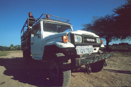
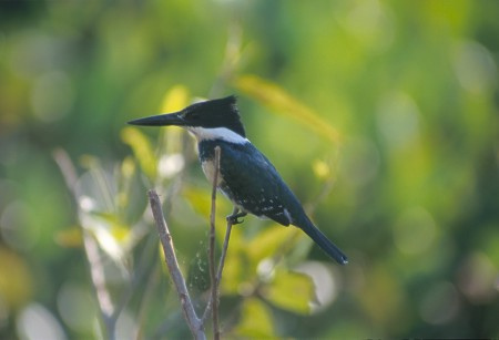
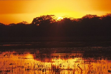
Photo Credits: Chapada dos Guimarães (Shutterstock/Alarico)
Pantanal Escapes